Schematization
In graphics and language, schematization is an important method to emphasize certain aspects and to deemphasize others. Different disciplines use schematization for different reasons. In cartography, graphic schematization is one aspect of map generalization. In contrast, cognitive science addresses schematization as a method to intentionally emphasize certain aspects of knowledge beyond technical necessity; therefore, we propose the notion of schematic map to denote maps that employ schematization for cognitive representational reasons.
We define schematization as (the result of) intentionally distorting a representation beyond technical needs to achieve cognitive adequacy and schematic representation as intentionally simplified representation aiming at cognitive adequacy.
In our project, we develop different methods for automatic schematization of geographic data. Broadly, these can be distinguished between top-down and bottom-up processes. Top-down processes employ (conceptual) prototypes in generating a representation (see theory of wayfinding choremes), while bottom-up processes manipulate existing data by, for example, simplifying a feature's geometry. These methods (together with more basic functionality for importing and exporting different types of data) are part of a schematization toolbox that we develop in our project.
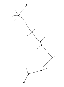
Subway maps are a good example of schematic maps. These maps concentrate on the connection between subway stations, i.e. they focus on representing topological information. Distance and direction information is only coarsely (qualitatively) represented and may well be distorted. The following figure shows an example subway map generated with one of our schematization approaches. This approach is based on discrete curve evolution. We also work on ways and consequences of combining different schematization methods, for example bottom-up and top-down schematization processes. An example for such combined application are wayfinding choreme maps (shown on the right).
Click here to evaluate different kinds of schematic maps produced with our schematization toolbox [requires flash].
Main publications
Denise Peters, Kai-Florian Richter (2008). Taking off to the Third Dimension - Schematization of Virtual Environments. In International Journal of Spatial Data Infrastructures Research (Volume 3, pp. 20-37). Special Issue, GI-DAYS 2007, Münster: Young Researchers Forum.
Alexander Klippel, Kai-Florian Richter, Thomas Barkowsky, Christian Freksa (2005). The Cognitive Reality of Schematic Maps . In Liqiu Meng, Alexander Zipf, Tumasch Reichenbacher (Eds.), Map-based Mobile Services - Theories, Methods and Implementations, pp. 57-74. Springer, Berlin.
Alexander Klippel, Kai-Florian Richter, Stefan Hansen (2005). Wayfinding Choreme Maps. In Stephane Bres, Robert Laurini (Eds.), Visual Information and Information Systems. 8th International Conference, VISUAL 2005, pp. 94-108. Springer, Berlin.